The 520 Shuffle: The 520 Shuffle is actually two separate "shuffles," the first occuring from traffic merging into the fast-lane of I-5 (see the Freeway below) at Mercer (see the Mercer Mess below) and then having to weave and shuffle through four lanes of almost always highly congested traffic in order to then be able to make the exit to Highway 520 and the Evergreen Point Floating Bridge. The same occurs in reverse (see the Mercer Weave below). Either way, it can be hair-raising, especially on a rainy morning or evening with your windows fogging up and 18-wheelers and rampaging 4x4's careening down the freeway at 70 mph plus, and of no mind to give way or slow down. Not for the meek or timid.
Alki: Can refer to either Alki Point, where the first Seattle settlers first landed and settled, or to Alki Beach. Alki Beach is the most popular summer hang-out and sunbathing spot for Seattle's teenagers.
The Artists' Republic of Fremont: A jocular reference to Fremont as a place apart.
The Ave: University Way, so go figure. I remember the term "the Ave" dating back to the late 60's, but the term very possibly goes back much further, back to when the street was still named 14th Ave NE. I'm not sure when the street name got switched (had to be sometime after the UW relocated there). In the late 60's, the Ave had several coffee houses lining it, including the Pamir House (or "P House") with its "Post No Balls" sign on its side (had originally read "Post No Bills"), the Eigerwand, the Edge, and others. The coffee houses featured folk music, jug bands, bluegrass, and jazz, with the occassional poetry reading thrown in. Cool, while it lasted.
Belltown: Was originally between Downtown proper and Denny Hill (now the flattened Regrade). The notion that Belltown was originally the red light district for Seattle, but with bells on the doors rather than red lights, is an entirely spurious one, I'm afraid. The tract, as well as Bell Street, was named after William Bell, one of the original members of the Denny Party, and roughly encompasses the same ground that Bell owned as part of the original Seattle plat. Today, Belltown is home to many small music clubs, art bars, and other cool hip places. Recently, Belltown was named as the seventh "coolest" place in the U.S.
Bellvoid: A putdown of Bellevue, the suburban city across the Lake from Seattle, supposedly due to "its total lack of culture and charm," as the reader who contributed this put it. I don't personally go that far, but one has to admit that what culture and charm is there is getting more and more difficult to get to, or discover in the first place, due to the Eastside's almost round-the-clock traffic gridlock.
Bertha: An "affectionate" name for the much stalled TBM (Tunnel Boring Machine) that is digging the Highway-99/Viaduct-replacement tunnel. Currently the largest TBM in the world (or was when if started boring, anyway). "Bertha" references Bertha Landes, Seattle's plus-sized mayor from the 1930s (the first female mayor of a major U.S. city).
Billville: Another term for the technology corridor that runs from Bellevue, Overlake, and Redmond, through Bothell, and up to the Everett area. Refers to Bill Gates, of course.
BINMIC: Supposedly stands for the Ballard Interbay Northend Manufacturing and Industrial Center. Whoa, that was a mouthful. Must be some kind of official designation, most likely for zoning purposes. Nothing anybody would actually say (acronym or full version).
Blahvue: The ultimate putdown of Bellevue, I think, contributed, by the way, by an Eastsider (but who obviously wishes he was a Westsider, or Seattlite). A variation of this is "Blah-ville."
The Bluff: Magnolia Bluff.
Boringham: Bellingham, supposedly.
Brenda: An name that has been attached to the TBM (Tunnel Boring Machine) that is boring the light-rail tunnel from downtown to Northgate, clearly mimicking "Bertha", the name for the much larger TBM boring the Viaduct-replacement tunnel. Not sure if "Brenda" refers to any person, living, dead, or fictional. Brenda Starr? Brenda Lee?
Broadmoor: The first walled and gated community for the exclusive in the country, I believe. With golf course. Historically deeds there carried covenants that precluded use or occupation "by any Hebrew or by any person of the Ethiopian, Malay or any Asiatic Race", except domestics.
Bummertown: Bremerton, located on the west side of Puget Sound, about an hour's ferry ride from Seattle. Home of the Puget Sound Naval Shipyards. "Bummertown" is apparently a term coined by local Bremerton teens, who obviously feel that being stuck on the wrong side of the Sound is a real bummer.
Burke-Gilman: The Burke-Gilman Trail, a rail line that has been converted into a trail for walkers, joggers, bikers, and so on. The name comes from the original builders of the rail line, Thomas Burke and Daniel Gilman. The trail now stretches all the way from 8th Avenue NW in Fremont to Kenmore and then onto a connection to the Samammish River Trail in Redmond. I spent two years of junior high and three years of high school living just north of the rail line (a half-block north of the Grandma Cookies factory and sign on Burke Ave. N.) back when it was still a working railroad. It was my favorite route to take between there and the U District -- it was very overgrown, so you could be in your own world down there, oblivious to almost everything else, except for the occasional warning horn of a train coming up behind you, albeit slowly, of course. I used to refer to the tracks as my "Buddha Tracks" and dream of running into Jack Kerouac or Neal Cassidy along them.
The Bus Tunnel: What the Transit Tunnel used to be called, before it was renovated to accomodate both buses and light-rail trains.
The Center of the Universe: What the denizens of Fremont have dubbed their home turf.
The CD: The Central District (also called the Central Area).
Chopstick Hill: Beacon Hill, referring to its relatively large Asian population.
Chuckanut Drive: A section of very scenic road running south from Bellingham between the Chuckanut Mountains and the Sound. It was part of the original Highway 99 (and before that, the Pacific Highway) between 1913 and 1931, before that highway was rerouted further inland (along the same route now generally followed by I-5 today).
The Counter-Balance: Queen Anne Avenue, running up South Queen Anne Hill. Originally was a real counter-balance, with a falling weight pulling a trolley up to the top of Q.A. Hill. For some reason Seattlites just keep on calling that stretch of steep street "The Counter-Balance" eventhough it was long gone before most of them were even born (actually, it's still there, buried under the street).
Warning: Non-Nortwesterners should use these terms (in the vain hope of fitting in) only at the risk of being greeted by frequent blank stares. While some terms are known by virtually all Northwesterners, and actually spoken by many, others are known only to some or a few, while spoken by even fewer. However, if you hear one said, armed with this lexicon, you'll know what is meant.
The District: The University District.
The Dry Shitties: A slightly scatalogical reference to the Tri-Cities.
The Eastside: Bellevue, Kirkland, Redmond, etc., but a term also used, primarily by TV weathermen, to refer to Eastern Washington.
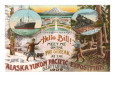
The Emerald City: Seattle. I believe this got started because of a newspaper poll, in which it was one of the choices. Quite frankly, however, I can't help but find the idea of Seattle as OZ to be completely revolting. When I was growing up around here, by the way, Seattle was always referred to as "The Queen City," a derivation that originated from the description of Seattle as "The Queen of the Pacific," dating back to the 1909 Alaska-Yukon-Pacific Exposition. That was, of course, before they realized there were "queens" in the Queen City.
Everott: Everett. Everett doesn't smell anywhere near as bad as it used to, now that they've closed down the pulp mills. Boy, it sure used to stink, though. Nothing like that rotten-egg sulfer smell on a bright sunny day, huh? We used to have to roll up our windows and hold our noses whenever we drove by Everett. Almost as bad as Tacoma...
The Free Ride Zone: Sometimes also referred to as the "Ride Free Zone." Officially designated as the "Ride Free Area" (although no-one but City officials called it that). Used to allow you to ride any bus free downtown within an area bordered, generally, by Battery Street on the north, S. Jackson Street on the South, and the Freeway on the East (except for in the Denny Regrade, where the eastern boundary is 6th Avenue, and in the International District, where the eastern boundary is 7th Avenue). But no more.
The Freeway: Always refers to Interstate 5 (I-5) and never to any of the other freeways in Seattle. I-5 was the first freeway built in Seattle, in the early 60's and has been rued by some for cutting off Downtown Seattle from the west sides of Capitol and First Hills. The general rule is that if you want to get anywhere fast during the rush hours, you should avoid the Freeway. Not to be confused with any other 4-lanes plus stretches of road, which are generally referred to specifically: 520, 405, 99, I-90, 509, and so on
The Freeway to Nowhere: SR 509, which runs from the First Avenue South Bridge down to the back-end of Sea-Tac. The freeway just sort of peters out at that point in a series of exits. There have been plans afoot for years to fill in the "missing link" between it and I-5, but it's all been bogged down in debate over the proper route (pushing a freeway through an urban area these days is no idle affair). The latest proposal involves plowing through four mobile home parks, as well as destroying about 200 other homes. 509 might also be called the "secret" freeway, since when I-5, 167, and all other north-south routes are clogged, it is likely to be free and clear, primarily because it doesn't really go where most people want to go. Still, if you want to go to Sea-Tac to catch an early morning flight, SR 509 is the only way to go -- you just need to know where to go once it peters out on you (keep your map handy).
Frellard: I saw this on a reader-board on Leary Way, mid-way between Fremont and Ballard, apparently designating the interstitial region between those two neighborhoods.
Garlic Gulch: A term for Rainier Valley, dating back to when it was largely populated by Italians. Seldom heard anymore, since the Italians are largely gone, replaced by a multi-cultural pastiche of various ethnic groups (Blacks, Asians, Chicanos, etc.). Still home, however, to the city's best Italian bakery and grocery. See also Pasta Gulch, a close variant, below.
Hellvue: Even another Bellevue putdown, more specifically referring to Bellevue's traffic. I remember when Bellevue was pretty much just a couple stop lights. Now, it's got its own office towers. (Seattle's traffic is pretty bad too. See The Mercer Mess below.)
The Highrises: In local traffic parlance, this refers to the east-end of the Evergreen Floating Bridge, which rises up off the water at that point. Sometimes referenced more fully as "the east highrises." Newcomers to town often think this refers to a bank of condos or something (yuk-yuk). See also The Hump.
The Hill: Capitol Hill. This one dates back to when I used to live on Capitol Hill, which admittedly was quite some time ago. Even then, it was a shortened expression used mostly by denizens of the Hill itself, but after all, it was the Scene, so could afford to ignore the umpteen other hills in Seattle. I now live on Queen Anne Hill, actually the west side of Queen Anne, spiritually really more part of Interbay (see below), once home for the Seattle Dump, and, as such, not exactly yuppie valhalla.
In a recent newspaper column, I ran across the promontory at the northend of Beacon Hill, where the headquarters of Amazon.com resides, being referred to as "the Hill." If this is actually used, it is solely among Amazonites, many of whom may be new to the area.
Hoo-ville: Magnolia. Refers to the similarity between the local Magnolia landscaping, strong on the bonsais and other scuptured shrubs, and that of Hoo-ville, the oh-so-cute town in the Dr. Seuss book, Horton Hears a Hoo.
The Hump: The 520 Hump. A section of the Evergreen Floating Bridge (520) that jogs over and rises up to allow for boat traffic to go underneath. More often than not, it seems, traffic is backed up to the Hump, then free-flowing afterwards, sort of like a roller coaster car straining to get to the top, then rushing down the other side. Much speculation, on my part, has gone into trying to divine the reason for this (I, myself, used to drive over the Hump five days a week). The back-up at the Hump is primarily in the eastbound lanes, and observation (from multiple crossings by yours truly) has shown the backup to be more in evidence on sunny than on rainy days, especially if the Mountain should be out, drawing me to conclude that motorists are actually pausing at the top of the Hump to take in the sights and look at the water, just long enough for the pause to oscillate and modulate itself back through the following traffic stream.
I-5: Interstate 5, which in Seattle is usually just referred to as "the Freeway." Note: True Seattleites never refer to I-5 as "the 5". Only out-of-towners, particularly Californians, do that.
The ID: The International District, which perhaps is home to too many other nationalities, including Japanese, Philipinos, Vietnamese, Cambodians, to accurately be called by its other namesake, Chinatown.
The Industrial Area: What the Sodo area was loosely referred to as prior to the building of the Kingdome. Now officially designated, with somewhat altered boundaries, excluding the sports stadiums and their immediate surroundings, as the Duwammish Industrial Area. Other "industrial areas" in Seattle include the South Lake Union area and the Interbay/Salmon Bay areas.
Interbay: Generally refers to a relatively amorphous area, the main features of which are the Burlington Northern rail yards and the landfill left over from when it was the city dump (now turned into a nine-hole golf course, however). Extensive mudflats were also "reclaimed" by the dumping of copious amounts of fill material from Seattles numerous "regrades" (including Denny Hill) early in the 20th Century. Lies between Elliot Bay on the south and Salmon Bay on the north (thus, Interbay), and Queen Anne Hill and Magnolia on the east and west. I lived a block up the flank of the west side of Queen Anne Hill for 13 years. Historically, the Interbay area and the lower west flank of Queen Anne Hill had a somewhat less than desirable reputation, due to its proximity to the city dump and the rail yards, as well as due to getting almost no over-the-air TV reception, due to being in the shadow of Queen Anne Hill (on top of which is where the TV broadcast towers for Channels 4, 5, and 7 are located). With the golf course replacing the landfill left over from the dump and most people now getting cable, the reputation of the area (hardly an official district as such) has improved somewhat, although the railyards, and their attendant noise, are still there. As a result, rents and property values there have jumped considerably.
Jefferson Davis Highway: As part of a national campaign to honor Jefferson Davis, president of the Confederate States of America, in 1939 the Daughters of the Confederacy erected markers in the state of Washington, at Vancouver and Blaine, the latter in Peace Arch Park, apparently with the blessings of the State Highway Department, to designate the main north-south highway through Puget Sound as "Jefferson Davis Highway No. 99," part of a national network of highways so designated by the UDC. This was in response to the designation of the first national highway as the "Lincoln Highway." As far as I know, this was never an official designation for Highway 99. Both markers were eventually relocated to Jefferson Davis Park, which was established by the United Confederate Veterans, a few miles north of Ridgefield, WA, along a stretch of Old 99. A bill some years back gained unanimous support in the state House -- it proposed to remove the remaining monument and designate the highway in honor of William P. Stewart, an African American who settled in Snohomish County after fighting on the side of the Union during the Civil War -- but died in the state Senate without a vote being taken on it. Defenders who wanted to keeping the markers have stressed Davis' role before the Civil War as Secretary of War, when his efforts aided the building of forts and roads in the Pacific Northwest. Those opposed pointed to the impropriety of naming a state highway after someone who renounced his U.S. citizenship, was accused of treason, and was a slave owner.
Jet City: Another term for Seattle, the city that Boeing built.
The Junction: Short for the West Seattle Junction, originally the intersection of California Way and S.W. Alaska St., where two street car lines once met, but now thought of as encompassing the surrounding neighborhood, as well.
Laurelhurst: One of Seattle's wealthiest neighborhoods, located to the northeast from the U. It is hardly suprising, I suppose, that an inordinate number of Seattle City Council members have been residents of Laurelhurst, despite the fact that the council positions are all elected on an at-large basis.
Latteland: Seattle, of course. So, why not Frappuccinoville, eh?
Lesser Seattle: A spoof on "Greater Seattle" started by columnist Emmett Watson many moons ago that has gained many local adherents.
The Loop: A loop in downtown Renton, composed of a couple one-way streets going opposite directions and connecting streets, that is a favorite teen cruising route. If someone says they went "cruisin' the loop," you'll know that they were driving around (and around) in downtown Renton, to see and be seen.
Lynnhood: Apparently what some of the local teens call the Lynnwood neighborhood. Also used to refer to Lynnwood High School (see the Places & Spaces page).
Metro: An agency formed to run both the transit and sewer treatment systems for King County, but is more generally used to refer to the transit system -- short for "Metro Transit," which took over the former local transit system, Seattle Transit. The omnibus Metro agency has actually now been absorbed back into the King County government. See the Metro Online home page for bus schedules, maps, and fares. The move to build a monorail system in Seattle is, of course, a return to a Seattle-only transit solution -- both constituent sides, Seattle residents and Eastside residents, tend to believe they are being shortchanged, while their opposite numbers are being advantaged, under the overall King County/Metro transit umbrella (the truth is that both sides are likely being shortchanged).
The Mercer Mess: Notorious traffic back-up, due to need to merge into the fast lane of the Freeway, then quickly cross five lanes of almost always congested traffic to make it to the exit to the 520 bridge. See also the 520 Shuffle.
The Mercer Weave: The mirror image of the the 520 Shuffle, but with traffic trying to merge from Highway 520 onto the fast lane, weaving across five often clogged lanes on southbound I-5, to get to the Mercer Street exit (the exit lane for which is also an entrance lane, to make matters even worse). Similar to running with the bulls in Spain, but with seatbelts fastened and with charging semis playing the bulls. In my opinion, the Mercer Weave is worse than the 520 Shuffle (which goes the opposite direction), since you have to cross five lanes (instead of four), the merge lane is much shorter (and more harzardous), and the entrance and exit are much closer to each other. Personally, I go out of my way to avoid the Mercer Weave, either taking the Roanoke exit to get to Eastlake or taking I-90 from the east instead of 520.
Microsoftland: Can refer to the Redmond/Overlake area where Microsoft's main campus is located, the Eastside, or the Greater Seattle area.
The Military Road: A road built between Steilacoom and Seattle between 1853 and 1860. A portion of that route still goes under the name of Military Road South.
Milky Way: Martin Luther King Way. See also MLK.
Moise Island: A term sometimes used in reference to Mercer Island, no doubt due to its relatively large Jewish population. Mercer Island is just across the I-90 floating bridge from Seward Park and Mount Baker, Seattle neighborhoods that have historically been home to many of Seattle's Jewish residents. Mercer Island, however, is hardly mostly Jewish (it is mostly rich, rather), any more than are Seward Park and Mount Baker.
MLK: Martin Luther King Way, which was formerly Empire Way South before it was renamed. See also Milky Way.
The Monorail: Okay, I admit it. I was once all for the new monorail system that we voted for, but have since lost a lot of faith in it. The main thing that bothers me is the current plan to tear down the current monorail (The Monorail) and replace it with the new monorail, plus cut across (bisect?) the Seattle Center, one of the few areas of open space and relative quiet in the downtown area. Both are ugly decisions. The first, to go down 5th Avenue and replace the original monorail, although camouflaged under the cover of being at the request of the local community, is really much more at the behest of real estate developers and speculators, who don't want the new monorail to continue down 2nd Avenue through Belltown, because they have plans for strings of high-rise condos along that street. Not going down 2nd Avenue, however, means adding millions of dollars to the cost of going from Downtown to the Seattle Center and then down to Elliott, since the path now chosen is at least 6 blocks longer than the Second Avenue route (close to 50% longer than the Second Avenue route), even when taking cutting across the Center into account, plus you have to figure the cost of demolishing the original monorail supports and stations into account. All of this to keep real estate developers happy. The fact of the matter is that you could take the additional costs involved in the current plan and probably have two or three times enough money to far more than suitably compensate every single property owner who might be impacted by the new monorail going down Second Avenue, have a much more direct and less time-consuming route out of downtown, and be able to keep the original monorail (The Monorail), which is, after all, an entirely profitable enterprise, besides being one of the few remaining relics from the 1962 Seattle World's Fair, which should be prized and preserved, not simply demolished with hardly a second thought (especially in the interest of raw human greed), not to mention desecrating the sacred grounds, themselves, by bisecting them with concrete pillars and rails, and rushing monorail cars every 15 minutes. If given another chance, quite frankly, I'd vote against it.
North Bay: A term designating a planned redevelopment area just north of the current Magnolia Bridge (which will be replaced and relocated) and west of the railroad corridor, apparently in reference to its being at the north end of Elliott Bay, forgetting for the moment that there is no actual body of water named North Bay -- the longstanding and historically significant name of the closest adjacent water is Smith Cove. One of the main peeves is the plan to allow buildings up to 110 feet, raising questions about traffic generated by thousands of additional jobs along a corridor (15th Ave. W.) that is already a traffic bottleneck, especially considering that the housing originally included in the plan has been eliminated, apparently at the request of the fish processors and other maritime businesses who'll be some of the primary tenants, although why anybody would want to live next to a fish processor is beyond me. Also, difficult to see how the area will ever become a housing mecca, even with the ready availability of water views, due to the nightly noise emanating from the rail yards (music to my ears, but probably cacophany to many others), and additional industrial development will only add to the noise. There are plans to create an expanded waterfront park (there is a sliver of a park there now), along with better trails and bike trails, which is good.
The Northend: North Seattle, north of the Ship Canal.
Northshore: The area north of Lake Washington, including Bothell, Kenmore, Mill Creek, and the surrounding area.
Orange County: The Eastside, a lament.
Pac Highway: Short for Pacific Highway South.
Pacific Highway South: Was the name for the main highway running south from Seattle back before highways were numbered. Today, a section of this route that became Highway 99 is still called by that name, running along the east side of Sea-Tac airport and is reknowned for having been the prime haunt of the Green River Killer, possibly the most prolific serial killer of all time. Also called "the Sea-Tac Strip."
Pasta Gulch: Another term for Rainier Valley, a variation of Garlic Gulch. Seldom heard, now that the Italians have largely moved on.
Pill Hill: First Hill, where many of Seattle's hospitals are located, not to be confused with Second Hill, which has only one hospital on it.
Plastic Plains: Apparently, according to one of my readers, another slam on the Eastside that they heard some years back.
Port Tortured: Port Orchard, on the Kitsap Peninsula. A lament, apparently, expressed by teens thereabouts miffed at being stuck on the wrong side of the Sound on Saturday night. A variant on this is Port Torture.
Puddle City: Seattle, no need to say more, although it should be noted that Seattle, being somewhat in the rain shadow cast by the Olympic Mountains, actually gets quite a bit less rain than is popularly presupposed.
Queen Anne: Queen Anne Hill. Looks straight across Lake Union at Capitol Hill. Increasingly, the cool place to be, especially for young professionals (yuppie valhalla).
Rain City: Seattle, a term of obvious derivation. See my comment above, however, added to the Puddle City term.
Rat City: White Center in West Seattle. There was once a city dump located near White Center, which is where all the rats came from (or where they were going), apparently. The dump is long gone, but the name lives on. Alternatively, I've been told that the name goes back to World War II -- White Center was just outside of the city limits and, with much more lenient alcohol laws than Seattle (those were the ol' blue law days), was a mecca for servicemen on leave, with "Rat City" being short for "Ration City" -- "sep rats" is a common foreshortened version of "separate rations" in the military. Needless to say, the separate rations referred to here were more likely of the liquid variety. Both stories can also be true, just intersecting and becoming confused with each other over time. Sailors have sometimes also been referred to as "water rats," going at least all the way back to Shakespeare.
The Regrade: The Denny Regrade, which is usually thought of as just to the north of, or overlapping and to the north of, Belltown. Denny Hill, considered one hill too many, and stunting the expansion of Downtown, was washed away with powerful water hoses (a technology developed during the Klondike gold rush), leaving behind the rather flat Regrade. Along with Belltown, home of Seattle's Grunge Scene.
Robber's Roost: The original moniker of Ellensburg, after a trading post of that name that was located there (and around which the town grew).
The S-Curves: A section of 405 that wends a serpentine path, down Renton way. Used to cause a good deal more of a traffic hold-up than it does now--they largely straightened the S-Curves a few years back, leaving them nowhere near as "Essy" as before. Hardly ever even hear of the S-Curves any more on the traffic reports.
Salmon Bay: Refers both to the waterway west of the Ballard Locks (which was a tideflat before the buiding of the Locks and the Ship Canal that links it now to Lake Union) and the maritime "industrial area" on both of its banks.
Sea-Tac: Refers to Seattle-Tacoma International Airport, located roughly half-way between Seattle and Tacoma, thus the name. Not to be confused with the city of Sea-Tac which abuts the airport and has recently been incorporated.
The Sea-Tac Strip: Another name for Pacific Highway South.
Skid Road: Originally Yesler Avenue, dividing Downtown from Pioneer Square (note: not Skid Row), down which logs were skidded to Denny's Mill, but later designating a rough area of cheap flop houses, rot-gut saloons, bordellos, soup kitchens, and missions encompassing Pioneer Square and First Avenue. Unfortunately, it has been largely restored, renovated and gentrified, with boutiques largely replacing the peep show parlors and pawn shops. Still, the homeless, whose home this area has always been, have all the same multiplied. The missions remain. For more info, see the National Park Service's Pioneer Square-Skid Road Historic District page.
The Smell by the Bay: Tacoma, on Commencement Bay. Refers to Tacoma's historical redolence. See "The Aroma From Tacoma" on my Misc. page for further details.
Snoose Junction: Ballard. Refers I'm told to the snuff (or "snoose") favored by the local Scandinavian population at one time. Ballard was originally home to most of the Scandinavian settlers in the area, who came here primarily for the fishing, and still has a sense, feel, and tempo (about 5 miles per hour slower) that is its alone. In fact, originally, Ballard was its own town, first settled in 1853, incorporated in 1889, and finally annexed by Seattle in 1907, and is still, bounded by the natural bounderies of Salmon Bay, the Sound, Phinney Ridge, and Crown Hill, very much a place apart. The fact that the Ballard Bridge seems to be up more often than down, only increases the sense of being cut off from the rest of Seattle.
Ballard is also home to Ballard High School, where the annual bazaar was at one time called the Snoose Junction Function. Ballard High School is forever immortalized in the following school cheer (contributed by a reader):
Lutefisk, lutefisk
Lefse, lefse,
We're from Ballard High School,
Yah, Sure Ya'betcha!
This ditty has also been claimed as originating from Pacific Lutheran University, with the third line reading as "We're the mighty Lutherans" (or alternatively "We're the Mighty Lutes," one might hazard to guess). The signifance of the association here, of course, is with the largely Scandinavian background of the local Lutheran community, with the largest population thereof concentrated in Ballard. Whether this ditty originated from Ballard High School or PLU is perhaps an unresolvable "chicken or the egg" mystery.
See the inballard.com home page for a guide to where in Ballard to eat, drink, shop, and sleep, plus museums, live music venues, and other attractions.
Sodo: The rather amorphous district that runs south of the Kingdome (or what was once the Kingdome). A reader has written me that the official meaning of "Sodo" is "South of Downtown." Well, the original meaning of Sodo was "South of the Dome," plain and simple, with the latter version, "South of Downtown" having been concocted by who knows who in City Hall, or at one of the local papers, once it became clear that the Dome was soon to be no more. I have also been informed, however, that the term Sodo actually predated the Kingdome, referring to "South Downtown," although it never came into wide usage, only to be dusted off later after the Kingdome was built. My personal experience was that, before the Kingdome was built, the area was almost universally referred to as "the industrial area" (and has continued to be referred to as such quite commonly).
Sound Transit: A regional transportation authority formed to coordinate the implementation and operation of a three-county transportation plan approved (on the second try) by the voters, the hallmark of which will be a light rail (and subway) line running initially, it is planned, between the U District and Sea-Tac, and through the Tunnel downtown. Lately, however, the Sound Transit plan has become mired in controversy and internecine neighborhood battles. The heart of the controversy involves Sound Transit's plan to put a subway tunnel, an extension of the Tunnel downtown (a.k.a., the Bus Tunnel), under both Capitol Hill, Portage Bay, and the U District. First, Rainier Valley, a largely minority community, with Seattle's largest housing projects (Holly Park and South Park), complained vociferously about the plan to run street-grade trains down the center of Martin Luther King Way, while the more affluent and whiter Capitol Hill and University District neighborhoods were getting a tunnel (and the lion share of the dollars). Tukwila (home of Southcenter) then complained that they were being by-passed entirely. Next, the Ravenna neighborhood, where it had been planned that the subway would surface and run on the ground, complained that they too deserved a tunnel (this controversy was nipped in the bud, however, when it was announced that the first phase would dead-end under the U District. Then, the University of Washington complained that trains running in the tunnel under the U District would upset and confuse delicate scientific instruments on campus. An attempt was made to shuffle money around to provide for a first-phase extension of the line to Northgate (which makes a LOT of sense), but only further raised the ire of Rainier Valley and other Southend residents who already felt they were getting the short end of the stick. The Downtown business community, awaking late to this brouhaha, started shaking and quaking after being told that not only would the buses be kicked out of the Tunnel while putting in the light rail, but that they'd be kicked out permanently (because of the need to regrade the section of the Tunnel east of the Westlake Station to run the trains under Capitol Hill, for even if the buses could share the tunnel with the trains, there'd be no way for them to get out once they got in). Visions of hundreds of largely suburban buses jamming Downtown's already jammed rush-hour streets danced before the eyes of Seattle's movers and shakers. More recently, major cost overruns have been projected, primarily for building the tunnel section of the line that is slated to run under Capitol Hill and the U District, throwing the future of the whole project, at least as presently conceptualized, into doubt. One of the options, it seems, would be to stub-off the line at the Boeing Access Road, leaving extending the line to Sea-Tac for the second phase, although this is sure to even further raise the ire of Seattle's southenders. In response to the mounting criticism and skepticism, the Sound Transit board has warned that if the local community doesn't put forward a unified front behind the current plan, then federal transportation dollars counted on to help finance the system will be placed in jeopardy.
A few faint voices have been heard from in the past (Mayor Schell, among them) suggesting that the tunnel under Capitol Hill and Portage Bay should be nixed, in favor of an elevated or street-grade line running out Eastlake, but were promptly jumped on and silenced. This is unfortunate, in that this would be the key, I think, to creating a system that would work and satisfy virtually all parties--the money saved by running an elevated line out Eastlake would easily finance extending the line out to Northgate (as well as keeping Sea-Tac as the southern terminus of the first phase). Additionally, since nobody would have a tunnel (except for Downtown), neither Rainier Valley nor Ravenna could complain about not getting one. Lastly, and this is the most important point, I think, since there would no longer be a need to regrade the Tunnel east of the Westlake Station, there would be no reason why both the trains and the busses couldn't share the Tunnel, once the light rail was put in. Everybody a winner, nobody a loser, in other words, which is, of course, way too much to hope for, at least in Seattle. The Sound Transit board, afflicted with a case of hardcore subway-itis (understandable in "New York, By and By," I suppose), has lashed itself to the mast while commanding that everyone else stick wax in their ears. Who knows, maybe if the Feds should turn down Sound Transit cold, that might be the best thing that could happen. Follow this link to go to the Sound Transit home page.
The Southend: South Seattle, roughly everything south of the Kingdome. Note that West Seattle is, in fact, a part of the Southend -- Seattle is too narrow to have a real Westend. Come to think of it, though, the popularity in West Seattle of various proposals to secede from Seattle can only be a testimonial to their real motivation, I think -- what they really want is to be out of South Seattle!
The Sunset Highway: Before there was I-90, there was US-10, and before they bothered to number national highway routes there was the Sunset Highway.
Swellvue: Another Bellevue putdown, referring to Bellevue's original character as a home of the rich, or at least well-to-do..
The Swish Alps: Most generally refers to the westside of Capitol Hill, referring to Capitol Hill's relatively large gay population, but I've also been told that it can refer to both Capitol Hill and Queen Anne Hill. This term is undoubtedly an import, most likely originating from either L.A. or San Francisco. There is an area in L.A., a hilly area adjacent to the Silverlake neighborhood with a large population of gays, that has long been referred to as the Swish Alps. San Francisco also has an area in the Castro District that is called the Swish Alps. "Swish Alps," in other words, might be used to refer to any elevation populated by gays.
Tangletown: This is a designation, apparently still being used by some old timers, for the area northwest of 50th Street and Stoneway Avenue, undoubtedly due to its tangled streets.
The Technology Corridor: A corridor in south Snohomish County, running roughly from Microsoft in the Redmond area, through Bothell, and to the Boeing Everett plant, featuring business parks rich in aerospace, biotech, communications, software, and other high-tech firms. Also sometimes just referred to as "The Tech Corridor."
Top Hat: The name of a district in Burien. My guess is that the Top Hat district is named after a now gone club, back when the blue laws ruled inside the Seattle City limits. There is a long-time gas station there, the Top Hat Gas Station, but somehow I doubt that the district is named after the gas station (more likely the gas station is named after the district).
Tri-Cities: Richland, Pasco, and Kennewick, three cities that are all fairly closely grouped along the Columbia River over on the eastside.
The Tunnel: Previously known as the Bus Tunnel, but now as the Transit Tunnel, now that it has been renovated for light-rail trains.
Troll Avenue North: A proposal is afoot to rechristen a two-block stretch of Aurora Avenue North, between North 34th and 36th Streets, as Troll Avenue North, in honor of the Freemont Troll statue, with part of the argument for the name change being the tendency of emergency vehicle drivers (ambulances, fire engines, and cop cars) to confuse that stretch of street with the same section of the Aurora Bridge roadway that is directly above it.
The U District: The University District, also often simply referred to as the District (see above).
The Viaduct: The Alaska Way Viaduct, an ugly two-level concrete eyesore built on fill and likely to collapse in an earthquake, but the only way to quickly by-pass Downtown if the Freeway is clogged up, which it is most of the time.
Uptown: There has recently been a move afoot to change the name of the Lower Queen Anne neighborhood to Uptown. Both the Uptown Theatre and Uptown Espresso are located there, but I don't think this area has ever really been called that (the espresso joint was named after the theatre, not the neighborhood, in that it originally catered largely to the movie crowds). The feeling, apparently, is that the term "lower" somehow confers an inferior status upon the area in comparison to the "upper" Queen Anne business district at the top of the hill and doesn't provide the area with its own independent identity. I lived in Lower Queen Anne for several years and can only say that I'll always refer to it as such, and will never refer to it as Uptown, which I think is just pure pretentiousness. Lower Queen Anne is home to three of Seattle's more venerable and still surviving greasy spoons, The Mecca, Sorry Charlie's, and Ozzie's (lots of smokers, however).
The Valley Freeway: SR 167, the alternative north-south freeway to I-5. Runs from I-405 and Renton down through Kent and then all the way down to Puyallup.
The Village: This generally refers to Magnolia's somewhat diminutive business district. I've heard, however, that the term is also sometimes used to refer to University Village (or U-Village), the shopping center out by the U. Apparently, the denizens of these two areas don't mix much.
The Westside: This is probably more of a journalistic invention, at least I can't actually remember it actually being said, just having read it in the newspaper. It does, however, catch the flavor of the Eastside's disdainful attitude to the, ahem, Westside, an increasing reluctance to accord centripetal weight to an urban core perceived variously as a nest of perfidious liberals (or Unitarians, egad!) or, alternatively, criminals, drug dealers, and other barely civilized barbarians, coddled, of course, by all those liberal Unitarians. Of course, the Westsiders might retort that it is the Eastsiders who are the true barbarians (social darwinist free-market free-booters). Per above, the term "Westside" is also sometimes used to refer to Western Washington.
We're dedicated to helping you find the exact poster or print you're looking for! If you can't find it here, and I'll see if I can hunt it down for you!
Contact:Bookmark this Site!
(IE or Firefox)